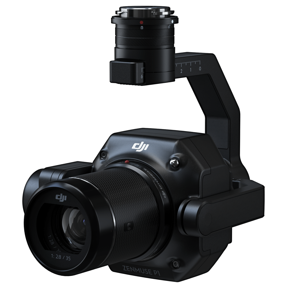
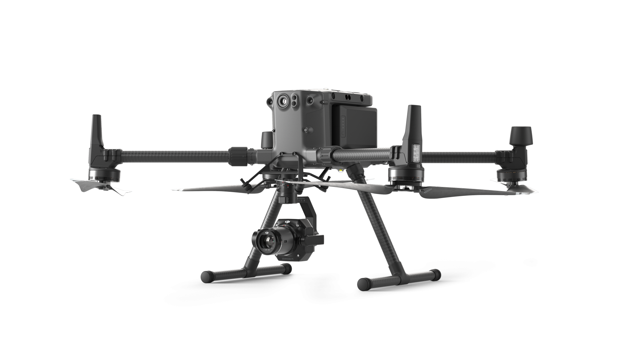
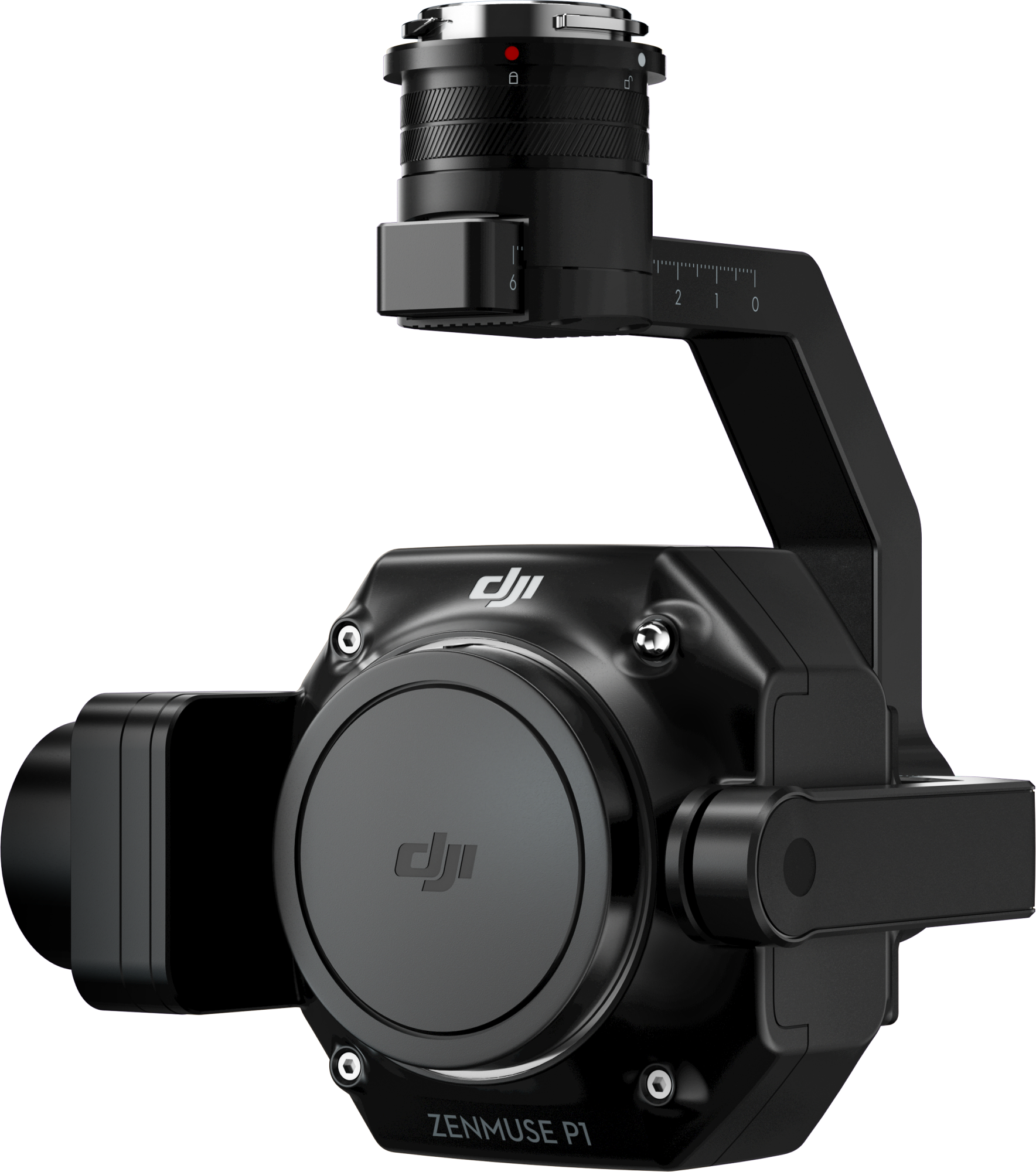
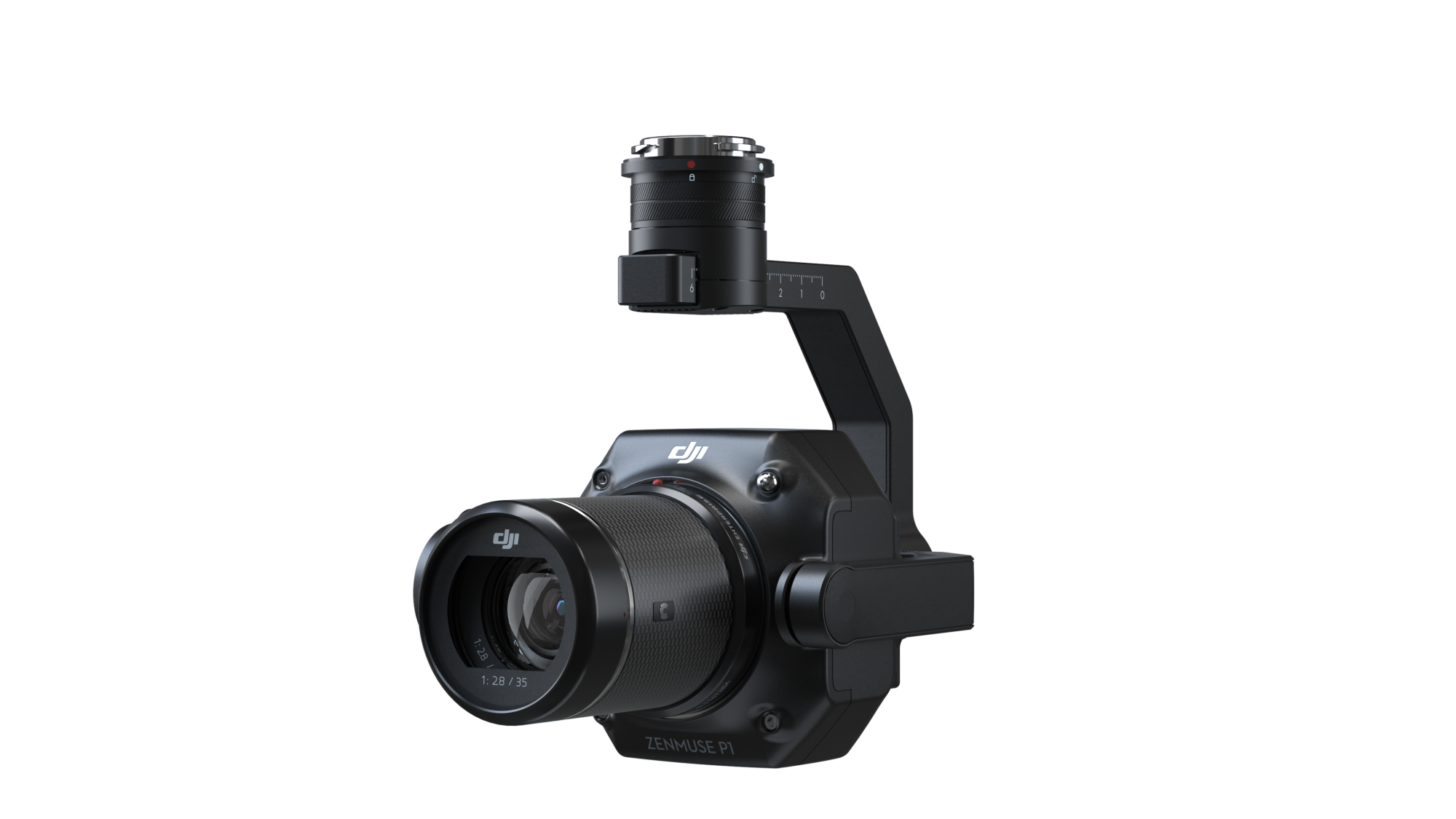
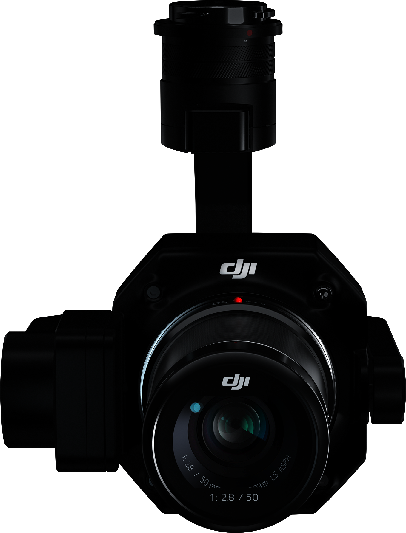
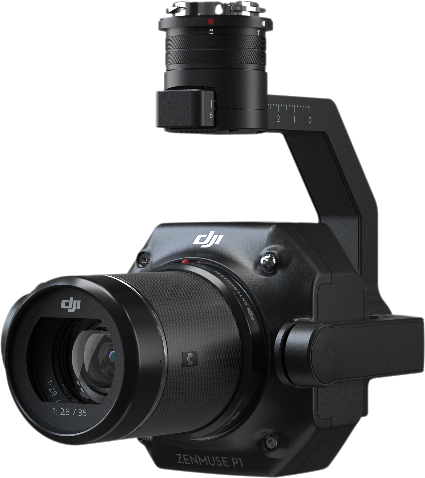
DJIPayloadsDrone CamerasZenmuse P1
Instant Clarity. Superior Accuracy.
The New Benchmark for Aerial Surveying
The Zenmuse P1 integrates a full-frame sensor with interchangeable fixed-focus lenses on a 3-axis stabilized gimbal. Designed for photogrammetry flight missions, it takes efficiency and accuracy to a whole new level.
- Description
- Specifications
Description
Zenmuse P1Efficiency through Flexible Full-frame Photogrammetry
Your Go-to Tool for Aerial Photogrammetry
Efficiency to Cover It All
Full-frame Camera
45MP Full-frame Sensor
4.4μm Pixel Size
Low-noise, high sensitivity imaging extends daily operational time
Take a photo every 0.7 s during the flight
TimeSync 2.0 aligns the camera, flight controller, RTK module, and gimbal at the microsecond level
4.4μm Pixel Size
Low-noise, high sensitivity imaging extends daily operational time
Take a photo every 0.7 s during the flight
TimeSync 2.0 aligns the camera, flight controller, RTK module, and gimbal at the microsecond level


Flexibility to Capture It All
Multiple Fixed-focus Lens Options
-Global Mechanical Shutter, Shutter Speed 1/2000 Seconds
-Sends the median exposure pulse in microseconds
-Supports 24/35/50mm lenses with DJI DL mounts
-Sends the median exposure pulse in microseconds
-Supports 24/35/50mm lenses with DJI DL mounts
Intelligent Features

Smart Oblique Capture
Cover 7.5 km2 in a single workday with the P1. Elevate the efficiency of your oblique photography mission using Smart Oblique Capture, where the gimbal automatically rotates to take photos at the different angles needed. Only photos essential to the reconstruction will be taken at the edge of the flight area, increasing the efficiency of post processing by 20% to 50%.
Smart Data Management
Your mission data management – streamlined.
-Mission result files are automatically associated with the Mission Name and Mission Time.
-A centralized storage location for photos, GNSS data, and TimeStamps.MRK files.
-The image metadata contains the camera’s intrinsic and extrinsic parameters and the status of RTK.
-Mission result files are automatically associated with the Mission Name and Mission Time.
-A centralized storage location for photos, GNSS data, and TimeStamps.MRK files.
-The image metadata contains the camera’s intrinsic and extrinsic parameters and the status of RTK.
Fieldwork Report
Verify data quality immediately post-flight by checking the position data and number of the images acquired, as well as RTK status and positioning accuracy.
APPLICATIONS
Topographic Mapping
Cadastral Surveying
AEC and Surveying
Natural Resource Management
Geological Investigation
Disaster Site Modeling
Contact Our Specialists
Specifications
General
Dimensions |
198×166×129 mm |
Weight |
Approx. 800 g |
Power |
20W |
IP Rating |
IP4X |
Supported Aircraft |
Matrice 300 RTK |
Operating Temperature Range |
-20° to 50° C (-4° to 122° F)
|
Storage Temperature Range |
-20° to 60° C (-4° to 140° F)
|
Absolute Accuracy |
Horizontal: 3 cm, Vertical: 5 cm *
* Using Mapping Mission at a GSD of 3 cm and flight speed of 15 m/s, with an 75% front overlap rate and a 55% side overlap rate. |
Camera
Sensor |
Sensor size (Still): 35.9×24 mm (Full frame)
Sensor size (Max video recording area): 34×19 mm Effective Pixels: 45MP Pixel size: 4.4 μm |
Supported Lenses |
DJI DL 24mm F2.8 LS ASPH (with lens hood and balancing ring/filter), FOV 84°
DJI DL 35mm F2.8 LS ASPH (with lens hood and balancing ring/filter), FOV 63.5° DJI DL 50mm F2.8 LS ASPH (with lens hood and balancing ring/filter), FOV 46.8° |
Supported SD Cards1 |
SD: UHS-I rating or above; Max capacity: 512 GB
|
Storage Files |
Photo / GNSS Raw Observation Data/ Image Log File
|
Photo Size |
3:2 (8192×5460)
|
Operation Modes |
Photo, Video, Playback
|
Minimum photo interval |
0.7 s
|
Aperture Range |
f/2.8-f/16
|
ISO Range |
Photo: 100-25600
Video: 100-25600 |
Video
Video Format |
MP4,MOV
|
Video Resolution | 16:9 (1920×1080) 16:9 (3840×2160)* *Only 35mm lens supported |
Frame Rate |
60fps
|
Gimbal
Stabilized System |
3-axis (tilt, roll, pan)
|
Angular Vibration Range |
±0.01° |
Mount |
Detachable DJI SKYPORT |
Mechanical Range |
Tilt: -130° to +40°; |
Reviews
There are no reviews yet.